My name is MAKO
Based in Sapporo, Hokkaido | Born and raised in Obihiro, Hokkaido | Lover of Sapporo Classic beer and fresh sashimi | Passionate about road trips and camping | Always chasing beautiful scenery
Why is Mikuni Pass called “Three Provinces Pass”?The Short Answer
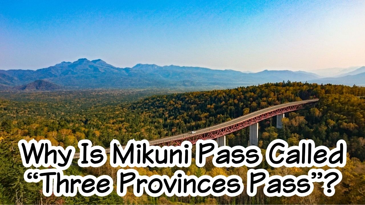
Mikuni Pass takes its name from the historical borders of Ishikari, Tokachi, and Kitami, three former provinces of Hokkaido. At 1,139 meters above sea level, it is also the highest mountain pass on a national highway in Hokkaido.
Today, travelers come for another reason: a breathtaking view over the forests of Daisetsuzan National Park and the bright red Matsumi Ohashi Bridge.

Why You Should Care
There are many beautiful roads in Hokkaido.
But Mikuni Pass feels different.
Stand at the viewpoint and look around.
There are almost no cities.
No large farms.
Few buildings.
Instead, there is forest stretching toward the horizon, mountains rising beyond it, and one red bridge curving through the trees.
Once you learn that the name “Mikuni” preserves the memory of Hokkaido’s old provincial borders, the view becomes more than beautiful.
You are looking at a landscape where history, geology, wilderness, and road engineering all meet.
Why Is It Called “Mikuni Pass”?
The Japanese name is:
三国峠 — Mikuni Toge
The word Mikuni can be read as:
mi = three
kuni = province or country
Here, “kuni” does not mean three modern nations.
It refers to the former provinces of Ishikari, Tokachi, and Kitami. Hokkaido’s official tourism organization states that Mikuni Pass takes its name from these old provincial boundaries.
What Were Ishikari, Tokachi, and Kitami?
Hokkaido did not always use the same administrative divisions that we know today.
In 1869, the Meiji government renamed Ezo as Hokkaido and divided the island into 11 provinces and 86 districts. Ishikari, Tokachi, and Kitami were three of those provinces.
Those divisions later disappeared.
But some place names survived.
Mikuni Pass is one of them.
So every time you say “Mikuni Pass,” you are repeating a small piece of Hokkaido’s 19th-century history.
How Was Mikuni Pass Built Through the Mountains?
Looking at the road today, it is easy to forget how remote this part of Hokkaido is.
National Route 273 crosses a vast mountain region between the Tokachi side and the Kamikawa–Sounkyo side.
Building a road here meant crossing deep forest, steep slopes, heavy snow, and one of Hokkaido’s wildest mountain areas.
Why Is Mikuni Pass Hokkaido’s Highest National Highway Pass?
Mikuni Pass stands at 1,139 meters above sea level.
That makes it the highest mountain pass on a national highway in Hokkaido.
The wording is important.
It is not necessarily the highest road anywhere in Hokkaido.
It is the highest national-highway pass.
That altitude explains why the air can feel noticeably cooler here, even when the plains below are warm.
It also explains why the views feel so open.
You are looking down over a huge part of the surrounding forest.
How Did National Route 273 Open Through the Mountains?
Road access through this area is relatively recent.
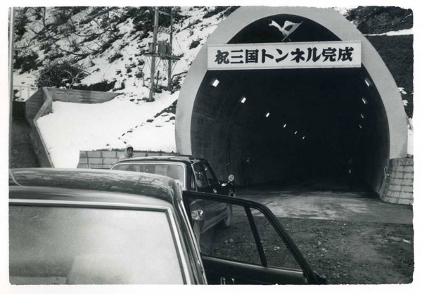
Kamishihoro Town records that the Mikuni Tunnel was completed in November 1971, followed by the full opening of National Route 273 through the area on November 1, 1972.
But the road did not immediately become the year-round scenic route travelers know today.
Further improvements continued over the following decades.
The famous Matsumi Ohashi Bridge was built in 1989, and Kamishihoro records the winter opening of Mikuni Pass in 1994.
That means today’s easy mountain drive is the result of decades of road construction and improvement.
Why Is the Scenery at Mikuni Pass So Spectacular?
Drive up to Mikuni Pass and the landscape suddenly seems to open.
The road rises above the forest.
Then you look down.
What you see is not just a valley.
It looks like an ocean made of trees.
Why Does the View Look Like an Endless “Sea of Forest”?
Mikuni Pass overlooks the wild eastern area of Daisetsuzan National Park.
Hokkaido’s official tourism site describes the view as an enormous forest stretching as far as the eye can see.
The forest is so large that human structures appear tiny.
Cars become dots.
Roads become thin lines.
Even a 330-meter bridge seems small.
But the story beneath the trees is much older than the road.
The Ministry of the Environment explains that the Tokachi-Mitsumata basin, visible in this part of eastern Daisetsuzan, is a caldera more than 10 kilometers across that was created by a massive volcanic eruption about one million years ago.
So when you look over the forest, you are looking across a landscape shaped by volcanic forces long before Hokkaido had roads, towns, or provincial borders.
Why Is Matsumi Ohashi Bridge Bright Red?
Then there is the bridge.
Among all that green forest, one structure immediately catches your eye:
Matsumi Ohashi Bridge.
It is about 330 meters long and approximately 30 meters high. Its red structure curves through the forest below Mikuni Pass and has become one of the area’s most recognizable views.
Its color creates a dramatic contrast throughout the seasons.
In summer:
red against deep green.
In autumn:
red against yellow and gold.
In winter:
red against snow.
But perhaps the most impressive thing is not how large the bridge looks.
It is how small it looks.
A 330-meter bridge is a major structure.
Yet inside this enormous forest, it almost disappears.
That difference in scale is one of the best ways to understand Hokkaido’s wilderness.
Why Is Mikuni Pass One of Hokkaido’s Best Scenic Drives?
Mikuni Pass is not the kind of destination where only the viewpoint matters.
The journey is part of the attraction.
This is one of those places where you understand why renting a car can completely change a Hokkaido trip.
What Makes the Drive to Mikuni Pass Special?
From the Tokachi side, National Route 273 passes through Kamishihoro and the Nukabira area before entering increasingly deep forest.
The towns become smaller.
Buildings disappear.
The road begins to climb.
Then the mountains open in front of you.
By the time you reach 1,139 meters, you are surrounded by a landscape that feels far removed from everyday Japan.
Official Kamishihoro tourism information gives one very important warning:
there is no gas station for roughly 110 kilometers between Kamishihoro and Kamikawa.
Fill up before you enter the mountain route.
In Hokkaido, “the next town” can be much farther away than you expect.
When Is the Best Time to Visit Mikuni Pass?
Mikuni Pass changes dramatically with the seasons.
Early summer brings bright new leaves.
Summer creates the classic deep-green sea of forest.
Autumn transforms the mountains into yellow and gold, with the red Matsumi Ohashi Bridge standing out even more strongly. Kamishihoro Tourism Association highlights both the summer forest and autumn foliage as major attractions.
Winter creates an entirely different landscape of snow and silence.
The road can be used in winter, but mountain weather can change quickly, and temporary closures can occur.
For a first trip from overseas, June through October is the easiest period to enjoy the drive.
Why Stop at Mikuni Pass Café?
At the top of the pass is a small reward for the drive:
Mikuni Pass Café.
The café serves hand-drip coffee, food, and soft-serve ice cream beside the viewpoint.
Current 2026 information from Kamishihoro Town lists the operating season from April 24, with winter closure from roughly early November to late April. The current listed hours are 8:30 a.m.–5:30 p.m.
There is something especially satisfying about sitting down with coffee after driving through kilometers of mountain forest.
Do not rush away.
Sit by the window.
Look at the mountains.
And notice how little human development you can see.
My Recommendation: Explore More of Kamishihoro After Mikuni Pass!
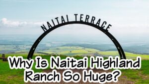
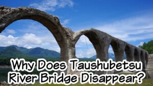
If you’re planning a scenic drive through Mikuni Pass, I highly recommend visiting Naitai Highland Ranch and Taushubetsu River Bridge as well!
Both are located in the Kamishihoro area and offer completely different experiences.
At Naitai Highland Ranch, you can enjoy breathtaking views of vast green hills and grazing cattle. Meanwhile, Taushubetsu River Bridge is famous as Hokkaido’s mysterious “Phantom Bridge,” which appears and disappears depending on the water level.
Combining these destinations is one of my favorite ways to experience the spectacular scenery of eastern Hokkaido!
Why Is Naitai Highland Ranch So Huge?
Discover the story behind Japan’s largest public ranch and its beautiful, wide-open landscapes.
Read next: Why Is Naitai Highland Ranch So Huge? The Story Behind Japan’s Largest Public Ranch
Why Does Taushubetsu River Bridge Disappear?
Why does this historic railway bridge sometimes vanish beneath the water?
Discover the fascinating mystery of Hokkaido’s famous Phantom Bridge!
Read next: Why Does Taushubetsu River Bridge Disappear? The Story Behind Hokkaido’s Phantom Bridge
Did You Know?
- Mikuni Pass is 1,139 meters above sea level, making it Hokkaido’s highest national-highway mountain pass.
- The name comes from the former provinces of Ishikari, Tokachi, and Kitami.
- Hokkaido was officially divided into 11 provinces and 86 districts in 1869.
- National Route 273 fully opened through this mountain area in 1972.
- Matsumi Ohashi Bridge is about 330 meters long and was built in 1989.
FAQ
Is Mikuni Pass the Highest Road in Hokkaido?
Not exactly.
It is the highest mountain pass on a national highway in Hokkaido, at 1,139 meters.
Other roads and mountain locations may reach higher elevations.
Does “Mikuni” Mean Three Countries?
Literally, kuni can mean “country” or “province.”
Here, it refers to the historical provinces of Ishikari, Tokachi, and Kitami, not three modern countries.
Can I Visit Mikuni Pass in Winter?
Yes, Route 273 can be used in winter.
However, severe snow and weather may cause temporary restrictions or closures.
The café and restroom facilities are closed during the winter season.
Is Mikuni Pass Free?
Yes.
There is no admission fee.
The official Hokkaido tourism site lists 15 free parking spaces at the viewpoint.
Can I Reach Mikuni Pass by Public Transportation?
For most travelers, a car is the practical choice.
There is no simple regular tourist bus that takes visitors directly to the viewpoint.
A rental car is strongly recommended if Mikuni Pass is part of your itinerary.
Visit It Yourself
Location
Mikuni Pass Observatory
Mitsumata, Kamishihoro, Kato District, Hokkaido
It is located on National Route 273 in the eastern Daisetsuzan mountain area.
Best Season
June–October
Visit in summer for the deep-green forest.
Choose early autumn if you want yellow and golden foliage around Matsumi Ohashi Bridge.
Winter can also be beautiful, but it is best suited to drivers experienced with Hokkaido snow roads.
How to Get There
From central Kamishihoro, Mikuni Pass is approximately:
60 km / about 1 hour by car.
From Otofuke-Obihiro IC, Hokkaido’s official tourism site gives a driving time of approximately:
120 minutes.
You can also approach from the Kamikawa and Sounkyo side along Route 273.
Remember:
there is no gas station for about 110 km between Kamishihoro and Kamikawa.
Fill your tank before the mountain drive.
Estimated Visit Time
Viewpoint only: 20–30 minutes
Viewpoint + café: 45–60 minutes
Mikuni Pass works best as part of a larger road trip through eastern Daisetsuzan.
Admission Fee
Free
Parking is also free.
Mikuni Pass Café
Current 2026 official information lists:
Season: April 24–early November approximately
Hours: 8:30 a.m.–5:30 p.m.
Winter: Closed
Official Website
Kamishihoro Tourism Association – Mikuni Pass
HOKKAIDO LOVE! – Mikuni Pass Observatory
Please check the official website for the latest information.
Final Thoughts
Why is it called Mikuni Pass?
Because long before travelers stopped here for photographs,
before Matsumi Ohashi Bridge,
before National Route 273,
Hokkaido was divided differently.
Ishikari.
Tokachi.
Kitami.
Three historical provinces gave this mountain area its name.
The old borders disappeared.
But the name remained.
Then people built a road through one of Hokkaido’s wildest mountain regions.
Tunnels crossed the mountains.
Bridges rose above the forest.
And a place once difficult to cross became one of Hokkaido’s great scenic drives.
Today, most travelers first notice the view.
The red bridge.
The endless trees.
The distant mountains.
But now you know what lies behind them:
old provincial borders,
a million-year-old volcanic landscape,
and decades of road construction.
Mikuni Pass is not just a high road through the mountains.
It is a place where Hokkaido’s history, wilderness, and journey all meet above an endless sea of forest.



コメント